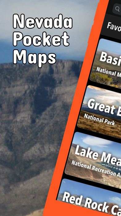
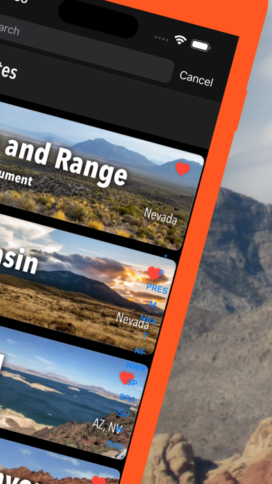
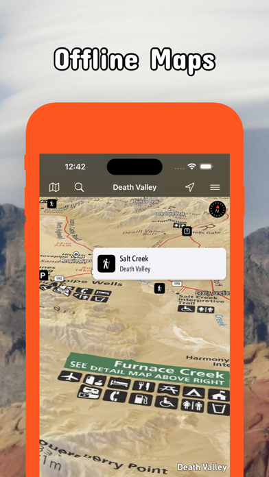
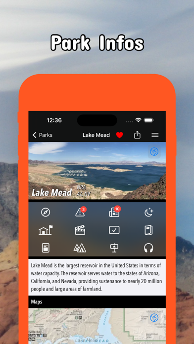
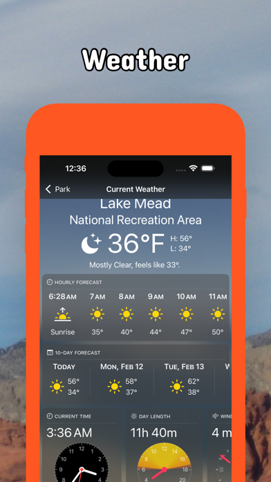
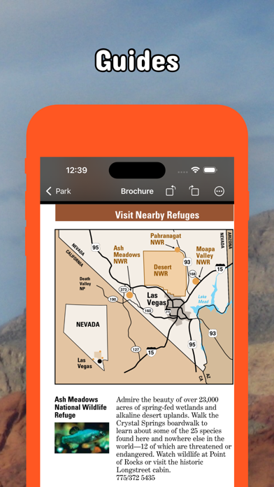
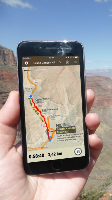
Be prepared! Plan your next trip to one of the great Nevada parks. Download maps and guides before you venture into the WiFi free wilderness. Discover - 70+ national parks, state parks, monuments, forests - 200+ neatly folded maps by the National Park Service, Bureau of Land Management, United States Forest Services, and other agencies. - Motor Vehicle Use Maps (MVUM), Motor Vehicle Travel Maps (MVTM) and visitor maps for Nevada national forests. - Off-Highway Vehicle (OHV) maps. - 500+ campgrounds and campsites - 900+ trails and trailheads - 31,000+ points of interests Plan - Download maps, park brochures, and newspapers. These downloads are ready when you are offline and off the grid in the great outdoors. - Download arbitrary map sections as offline packs. - Photo galleries, panorama views. - Share links to parks and maps with friends Have fun - GPS and GPX support: record your hikes, import GPX routes, tracks and waypoints for your hiking trails. - Detailed national park information: alerts, news, visitor centers, campgrounds, driving directions, weather. - Open your favorite maps app to get a route to the selected park. - Current weather conditions, easy access to multi-day forecasts, sunrise and sunset times. - Push notifications for park alerts, park news, weather warnings So download maps and guides for: Basin and Range Beaver Dam Berlin-Ichthyosaur Big Bend of the Colorado Black Rock Desert - High Rock Canyon Emigrant Trails Cathedral Gorge Cave Lake Death Valley Desert Dry Valley Gold Butte Great Basin Humboldt-Toiyabe Inyo Kershaw-Ryan Lake Mead Lake Tahoe Red Rock Canyon Rye Patch Sheldon Sloan Canyon South Fork Spooner Lake & Backcountry Spring Mountain Ranch Spring Mountains Valley of Fire Ward Charcoal Ovens Washoe Lake Wild Horse There are additional useful information and brochures for: Anaho Island, Arrow Canyon, Eldorado, Ireteba Peaks, Jumbo Springs, La Madre Mountain, Lime Canyon, Million Hills, Mount Charleston, Mount Stirling, Muddy Mountains, North McCullough, Rainbow Mountain, Resting Springs, South McCullough, Spirit Mountain, Stillwater, Wee Thump Joshua Tree. - FULL ACCESS is available for a for $3.49/three month (after a free 3-days trial period) or $2.49/two months or $7.49/year. You can subscribe and pay through your iTunes account. The account will be charged for renewal within 24-hours prior to the end of the current period, and identify the cost of the renewal. Your subscription will automatically renew unless canceled at least 24 hours before the end of the current period. Auto-renew can be turned off anytime by going to your Account Settings in iTunes after purchase. - Continued use of GPS running in the background can dramatically decrease battery life. LEGAL Terms of Use: https://www.icoat.de/pocketmaps/terms Privacy Policy: https://www.icoat.de/pocketmaps/privacy