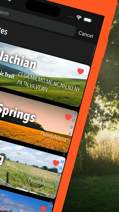
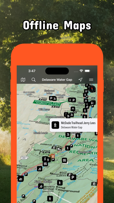
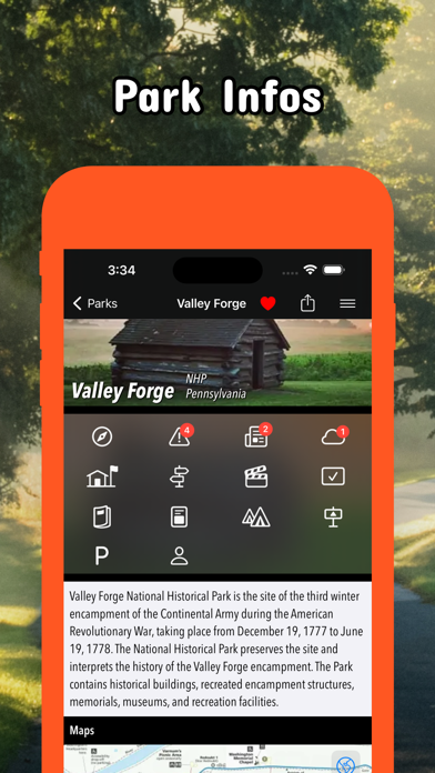
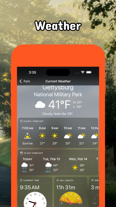
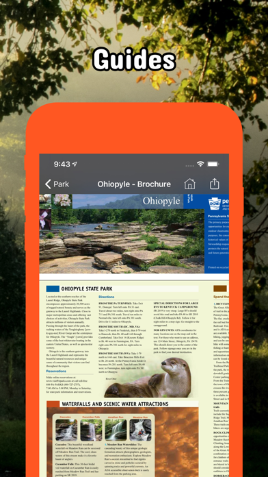
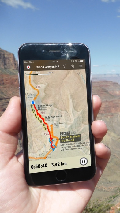
Be prepared! Plan your next trip to one of the great Pennsylvania parks. Download maps and guides before you venture into the Wi-Fi free wilderness. Discover - 75+ national parks, state parks, monuments, forests - 150+ neatly folded maps by the National Park Service, Bureau of Land Management, United States Forest Services, and other agencies. - 100+ campgrounds and campsites - 1,600+ trails and trailheads - 72,000+ points of interests Plan - Download maps, park brochures, and newspapers. These downloads are ready when you are offline and off the grid in the great outdoors. - Download arbitrary map sections as offline packs. - Photo galleries, panorama views. - Share links to parks and maps with friends Have fun - GPS and GPX support: record your hikes, import GPX routes, tracks and waypoints for your hiking trails. - Detailed national park information: alerts, news, visitor centers, campgrounds, driving directions, weather. - Open your favorite maps app to get a route to the selected park. - Current weather conditions, easy access to multi-day forecasts, sunrise and sunset times. - Push notifications for park alerts, park news, weather warnings So download maps and guides for: * Allegheny, Allegheny Islands, Allegheny Portage Railroad, Appalachian, Archbald Pothole * Bald Eagle, Beltzville, Bendigo, Benjamin Rush, Big Pocono, Big Spring, Black Moshannon, Blue Knob, Boyd Big Tree, Buchanan's Birthplace, Bucktail * Caledonia, Canoe Creek, Captain John Smith Chesapeake, Champman, Cherry Springs, Cherry Valley, Chesapeake Bay, Chesapeake Bay Gateways and Watertrails Network, Codorus, Colonel Denning, Colton Point, Cook Forest, Cowans Gap * Delaware & Lehigh, Delaware Canal, Delaware Water Gap, Denton Hill * Edgar Allen Poe, Eisenhower, Elk, Erie, Erie Bluffs, Evansburg * First State, Flight 93, Fort Necessity, Fort Washington, Fowlers Hollow, Frances Slocum, French Creek, Friendship Hill * Gettysburg, Gifford Pinchot, Gloria Dei Church, Gouldsboro, Greenwood Furnace * Hickory Run, Hopewell Furnace * Independence * John Heinz at Tinicum, Johnstown Flood, Journey Through Hallowed Ground * Kinzua Bridge * Laurel Hill, Laurel Ridge, Lehigh Gorge, Lower Delaware * Moraine * Nockamixon, North Country, * Ohiopyle, Oil Creek, Oil Region * Potomac Heritage, Presque Isle, Prince Gallitzin, Pymatuning * Raccoon Creek, Ricketts Glen, Rivers of Steel * Shawnee, Steamtown, * Thaddeus Kosciuszko, Tobyhanna * Upper Delaware * Valley Forge * Washington-Rochambeau Revolutionary Route - FULL ACCESS is available for a for $3.49/three month (after a free 3-days trial period) or $2.49/two months or $7.49/year. You can subscribe and pay through your iTunes account. The account will be charged for renewal within 24-hours prior to the end of the current period, and identify the cost of the renewal. Your subscription will automatically renew unless canceled at least 24 hours before the end of the current period. Auto-renew can be turned off anytime by going to your Account Settings in iTunes after purchase. - Continued use of GPS running in the background can dramatically decrease battery life. LEGAL Terms of Use: https://www.icoat.de/pocketmaps/terms Privacy Policy: https://www.icoat.de/pocketmaps/privacy