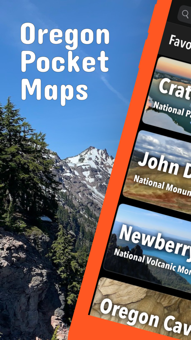
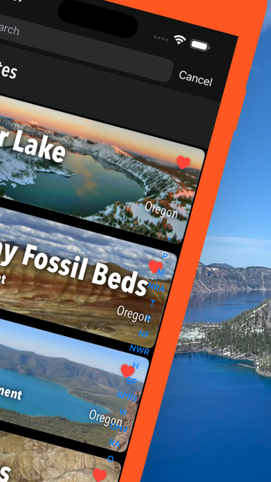
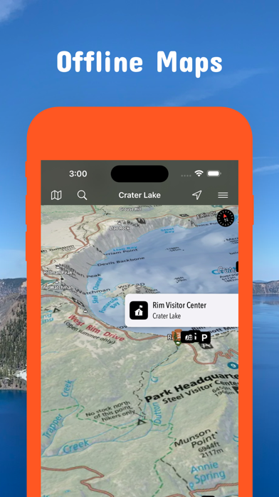
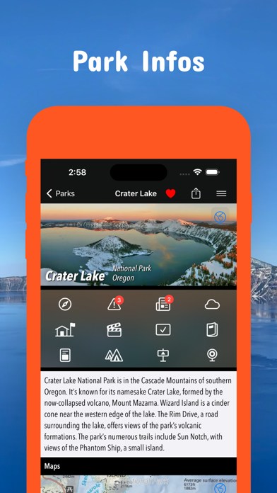
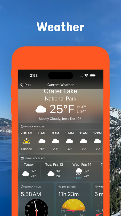
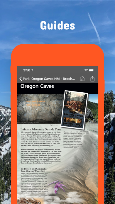
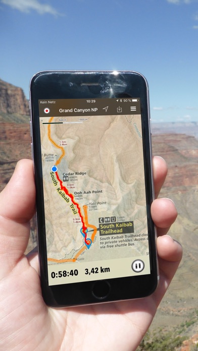
Be prepared! Plan your next trip to one of the great Oregon parks. Download maps and guides before you venture into the Wi-Fi free wilderness. Discover - 125+ national parks, state parks, monuments, forests - 400+ neatly folded maps by the National Park Service, Bureau of Land Management, United States Forest Services, and other agencies. - Motor Vehicle Use Maps (MVUM), Motor Vehicle Travel Maps (MVTM) and visitor maps for Oregon national forests. - 1.700+ campgrounds and campsites - 3.400+ trails and trailheads - 68,000+ points of interests Plan - Download maps, park brochures, and newspapers. These downloads are ready when you are offline and off the grid in the great outdoors. - Download arbitrary map sections as offline packs. - Photo galleries, panorama views. - Share links to parks and maps with friends Have fun - GPS and GPX support: record your hikes, import GPX routes, tracks and waypoints for your hiking trails. - Detailed national park information: alerts, news, visitor centers, campgrounds, driving directions, weather. - Open your favorite maps app to get a route to the selected park. - Current weather conditions, easy access to multi-day forecasts, sunrise and sunset times. - Push notifications for park alerts, park news, weather warnings So download maps and guides for: Alesa Falls Carpenter Bypass Cascade-Siskiyou Cathedral Hills Chickahominy Chimney Rock Christmas Valley Sand Dunes Clackamas Cow Creek Crater Lake Crooked River Derrick Cave Deschutes Diamond Craters Donner und Blitzen Dry River Canyon Eight Dollar Mountain Elkhorn Creek Enchanted Forest/Felton Four Craters Lava Bed Fremont-Winema Gerber Grande Ronde Grizzly Peak Hyatt Lake John Day Jordan Craters Keeney Pass Kiger Creek Klamath Lake Abert and Abert Rim Leslie Gulch Malheur Mann Lake Maston Trail Mickey Hot Springs Middle Santiam Millican Valley OHV Moon Reservoir National Historic Oregon Trail Nestucca River Nez Perce North Bank North Umpqua River Ochoco Oregon Badlands Wilderness Oregon State Map Owyhee Below Dam Powder River Priest Hole Quartzville Creek Rogue River Rogue River-Siskiyou Salmon River Sandy River Sheldon Shotgun Creek OHV South Fork John Day River Spring Steen Mountain Sterling Mine Ditch Trail Table Rocks, Umatilla Wallowa River Warner Wetlands ACEC Whittaker Creek Wild River Wildhorse Creek Willamette - FULL ACCESS is available for a for $3.49/three month (after a free 3-days trial period) or $2.49/two months or $7.49/year. You can subscribe and pay through your iTunes account. The account will be charged for renewal within 24-hours prior to the end of the current period, and identify the cost of the renewal. Your subscription will automatically renew unless canceled at least 24 hours before the end of the current period. Auto-renew can be turned off anytime by going to your Account Settings in iTunes after purchase. - Continued use of GPS running in the background can dramatically decrease battery life. LEGAL Terms of Use: https://www.icoat.de/pocketmaps/terms Privacy Policy: https://www.icoat.de/pocketmaps/privacy