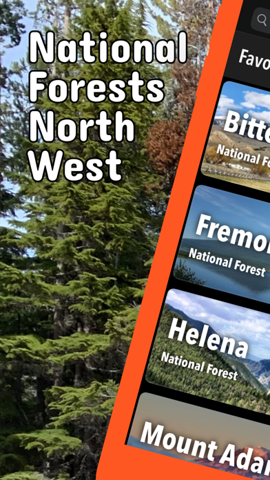
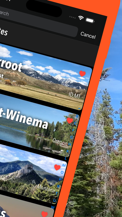
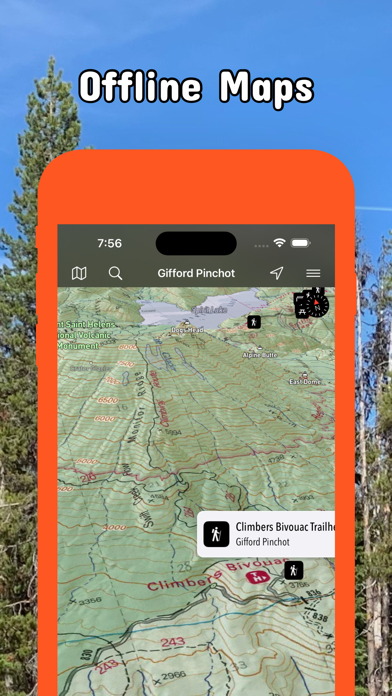
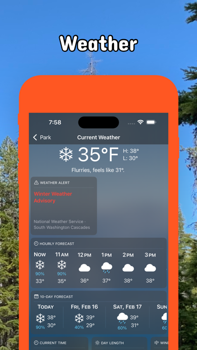
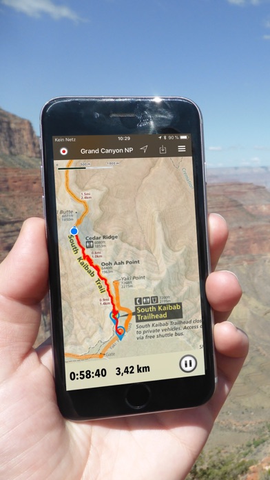
Be prepared! Plan your next trip to one of the great U.S. National Forests in the Northwest. Download maps and guides before you venture into the Wi-Fi free wilderness. Discover - 66+ national parks, state parks, monuments, forests - 440+ neatly folded maps by the National Park Service, Bureau of Land Management, United States Forest Services, and other agencies. - Motor Vehicle Use Maps (MVUM), Motor Vehicle Travel Maps (MVTM) and visitor maps for national forests. - 5,000+ campgrounds and campsites - 8,000+ trails and trailheads - 280,000+ points of interests Plan - Download maps, park brochures, and newspapers. These downloads are ready when you are offline and off the grid in the great outdoors. - Download arbitrary map sections as offline packs. - Photo galleries, panorama views. - Share links to parks and maps with friends Have fun - GPS and GPX support: record your hikes, import GPX routes, tracks and waypoints for your hiking trails. - Detailed USFS campground and trailhead information. - Open your favorite maps app to get a route to the selected park. - Current weather conditions, easy access to multi-day forecasts, sunrise and sunset times. - Push notifications for park alerts, park news, weather warnings So download maps and guides for: ALASKA - Chugach, Tongags IDAHO - Bitterroot, Boise, Caribou-Targhee, Curlew, Idaho Panhandle, Nez Perce, Payette, Salmon-Challis, Sawtooth MONTANA - Bitterroot, Helena, Idaho Panhandle, Lewis and Clark, West Yellowstone OREGON - Columbia River Gorge, Deschutes, Fremont-Winema, Malheur, Middle Santiam, Newberry, Ochoco, Rogue River-Siskiyou, Umatilla, Willamette WASHINGTON - Columbia River Gorge, Colville, Gifford Pinchot, Goat Rocks, Idaho Panhandle, Mount Adams, Mount St Helens, Mt. Baker-Snoqualmie, Okanogan, Wenatchee WYOMING - Bighorn, Black Hills, Bridger-Teton, Caribou-Targhee, Medicine Bow, Shoshone, Thunder Basin --- - FULL ACCESS is available for a for $3.49/three month (after a free 3-days trial period) or $2.49/two months or $7.49/year. You can subscribe and pay through your iTunes account. The account will be charged for renewal within 24-hours prior to the end of the current period, and identify the cost of the renewal. Your subscription will automatically renew unless canceled at least 24 hours before the end of the current period. Auto-renew can be turned off anytime by going to your Account Settings in iTunes after purchase. - Continued use of GPS running in the background can dramatically decrease battery life. LEGAL Terms of Use: https://www.icoat.de/pocketmaps/terms Privacy Policy: https://www.icoat.de/pocketmaps/privacy