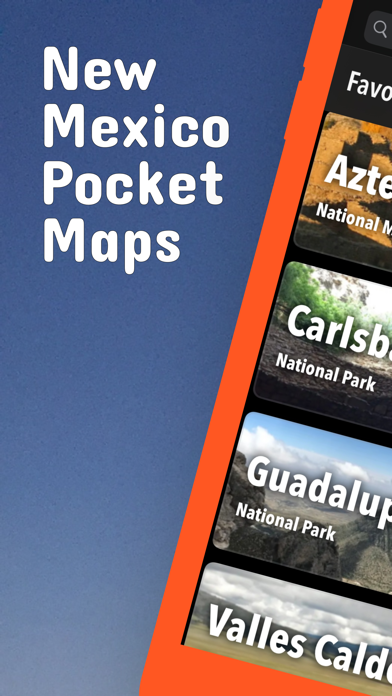
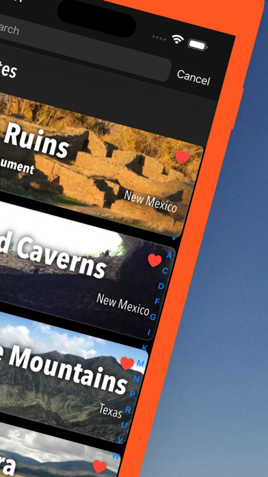
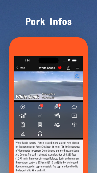
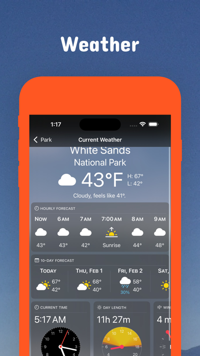
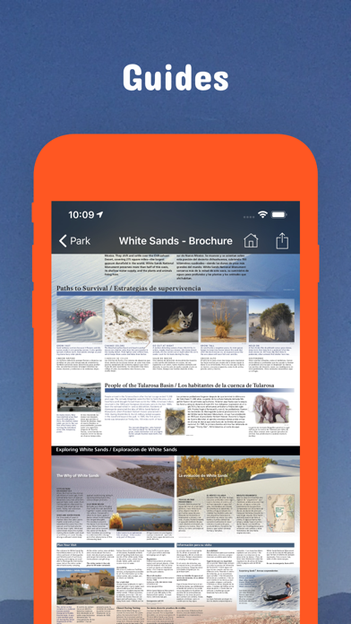
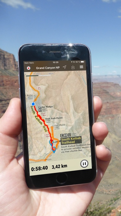
Be prepared! Plan your next trip to one of the great New Mexico parks. Download maps and guides before you venture into the Wi-Fi free wilderness. Discover - 90+ national parks, state parks, monuments, forests - 150+ neatly folded maps by the National Park Service, Bureau of Land Management, United States Forest Services, and other agencies. - Motor Vehicle Use Maps (MVUM), Motor Vehicle Travel Maps (MVTM) and visitor maps for national forests. - 600+ campgrounds and campsites - 2,000+ trails and trailheads - 58,000+ points of interests Plan - Download maps, park brochures, and newspapers. These downloads are ready when you are offline and off the grid in the great outdoors. - Download arbitrary map sections as offline packs. - Photo galleries, panorama views. - Share links to parks and maps with friends Have fun - GPS and GPX support: record your hikes, import GPX routes, tracks and waypoints for your hiking trails. - Detailed national park information: alerts, news, visitor centers, campgrounds, driving directions, weather. - Open your favorite maps app to get a route to the selected park. - Current weather conditions, easy access to multi-day forecasts, sunrise and sunset times. - Push notifications for park alerts, park news, weather warnings So download maps and guides for: Aldo Leopold Wilderness Apache-Sitgreaves Aztec Ruins Bandelier Bisti/De-Na-Zin Blue Range Wilderness Cabezon Canyons Capulin Volcano Carlsbad Caverns Carson Chaco Culture Chain of Craters Cibola Datil Well El Malpais El Morro Fort Stanton - Snowy River Cave Gila Wilderness Gila Cliff Dwellings Guadalupe Mountains Ignacio Chavez Kasha-Katuwe Tent Rocks Manzanita Mountains Kiowa Organ Mountains Desert Peaks Pecos Petroglyph Placita Prehistoric Trackways Rio Grande del Norte Sabinoso Salinas Pueblo Missions Santa Cruz Lake Santa Fe Valles Caldera West Malpais White Sands There are additional useful information and brochures for: Fort Union NM, Manhattan Project NHP, Bluewater Lake SP, Bottomless Lakes SP, Brantley Lake SP, Caballo Lake SP, Cerrillos Hills SP, Cimarron Canyon SP, City of Rocks SP, Clayton Lake SP, Conchas Lake SP, Coyote Creek SP, Eagle Nest Lake SP, El Vado Lake SP, Elephant Butte Lake SP, Fenton Lake SP, Heron Lake SP, Hyde Memorial SP, Leasburg Dam SP, Living Desert Zoo & Gardens SP, Manzano Mountains SP, Mesilla Valley Bosque SP, Morphy Lake SP, Navajo Lake SP, Oasis SP, Ojito Wilderness, Oliver Lee Memorial SP, Pancho Villa SP, Percha Dam SP, Rio Grande Nature Center SP, Rockhound SP, Santa Rosa Lake SP, Storrie Lake SP, Sugarite Canyon SP, Sumner Lake SP, Ute Lake SP, Villanueva SP - FULL ACCESS is available for a for $3.49/three month (after a free 3-days trial period) or $2.49/two months or $7.49/year. You can subscribe and pay through your iTunes account. The account will be charged for renewal within 24-hours prior to the end of the current period, and identify the cost of the renewal. Your subscription will automatically renew unless canceled at least 24 hours before the end of the current period. Auto-renew can be turned off anytime by going to your Account Settings in iTunes after purchase. - Continued use of GPS running in the background can dramatically decrease battery life. LEGAL Terms of Use: https://www.icoat.de/pocketmaps/terms Privacy Policy: https://www.icoat.de/pocketmaps/privacy